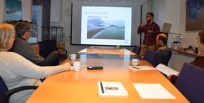
Sediment transport and bathymetric change at Hornafjörður tidal inlet
Master thesis about "Grynnslin" and "Ósinn" in Hornafjörður
A master's thesis in engineering at the University of Lund, Sweden, which deals with Hornafjörður and Grynnslin has not been published. The project was carried out by Clemens Klante's German student who did so well in his studies that he was chosen to work on a doctoral project at the university. He introduced his project to the maritime division of the Icelandic Road and Coastal Administration last fall.
The article was published in the Swedish magazine Tidskriften Vatten or the Water Magazine and can be found here .
The relatively calm area behind barrier island are favoured locations for harbors even though the navigation through the inlet itself can be challenging. Different measures like dredging or coastal structures might be necessary to ensure the desired water depth to maintain a safe navigation. Iceland as an island country depends strongly on reliable navigational routes connecting harbors to the ocean to ensure its economic wealth.
The port of Höfn at the Hornafjörður inlet in South-eastern Iceland is the main navigational link for the commercial fishing in this area. The interactions between longshore sediment transport and sediment transport induces by the inlet flow and waves are complex and led to navigational limitations in history. A deeper understanding of local transport patterns is needed to ensure a reliable navigation at the Hornafjörður inlet and limit economic losses in future.
Regarding the complexity of the situation around the inlet and the limited data on local hydrodynamics, mathematical modelling must be used to simulate local currents. This article focuses on the research performed and model results gained in connection with the master thesis project “Sediment transport and bathymetric change at Hornafjörður tidal inlet – Field data analysis and mathematical modelling” (Klante, 2018).


